
- It’s what we do – adventure motorbike magazine
- BMW GS Safari Enduro = adventure motorbikes, news, reviews, publication
- BMW F850GS Rallye X
- Strap Yourself In
- The Dempster
- TomTom Rider 450
- Read Between The Lines
- Locked Gates – motorbike magazine, australian motorcycle publication
- Ural Adventure Ride 2018
- Sri Lanka – adventure motorbike tour, motorcycle magazine
- The Best Job In The World = australian motorbike magazine
- Wet Arses
- Yamaha Tracer 900
- Congregation 2018
- We Didn’t Have PLBs In Those Days
- Sahara To Sunraysia = australian motorbike riding tours news event magazine
- Managing Risk with Miles Davis
- Thinking Big? Start Small with Andy Strapz
- A Precautionary Tale from Karen Ramsay
- Checkout
- Fit out – australian adventure motorbike riding
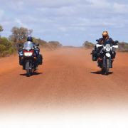
Canada’s road to the Arctic Don Bromfield took a look at one of Canada’s newest all-weather roads.
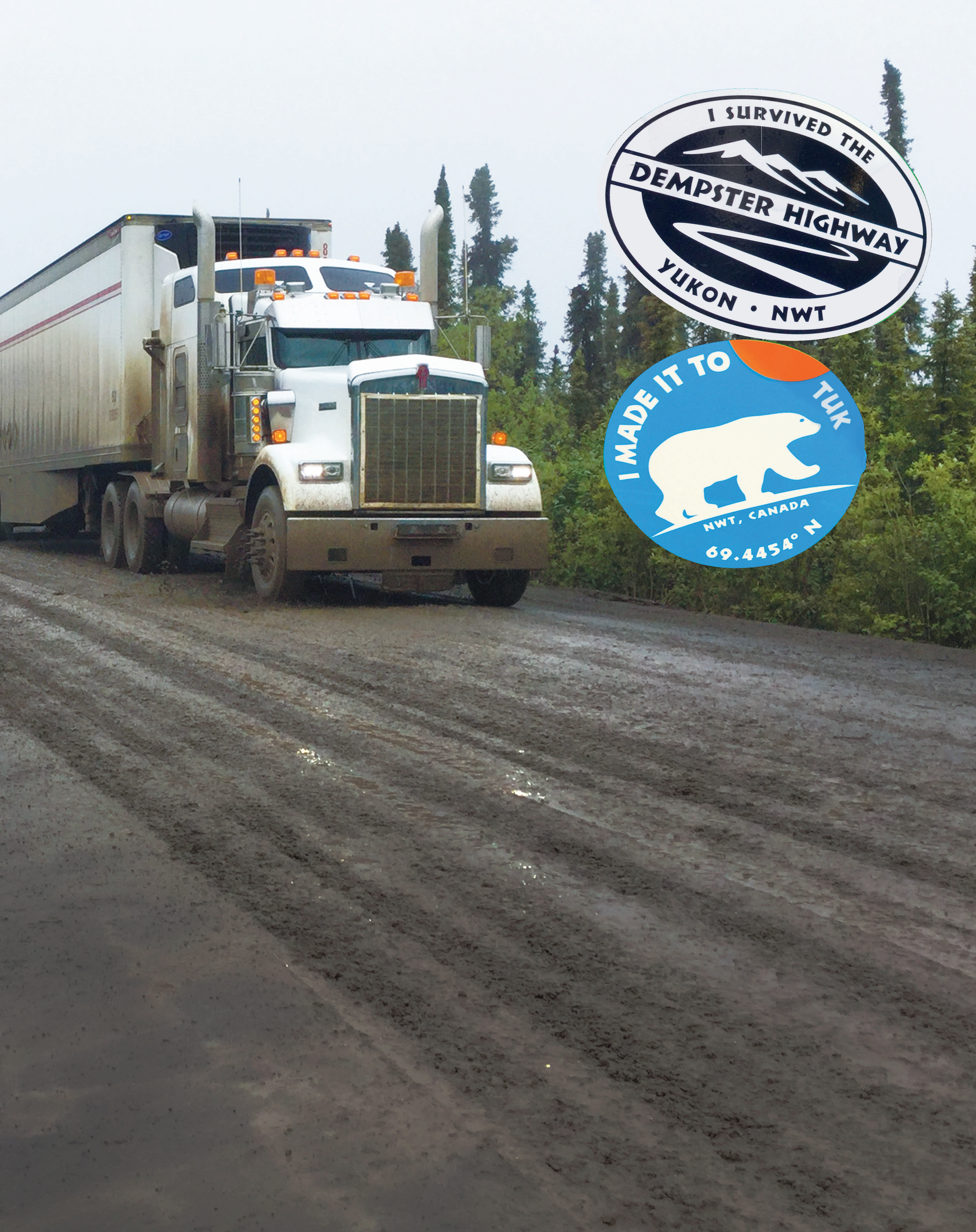
November of 2017 saw the opening of the final 140km of The Dempster Highway from Inuvik to Tuktoyaktuk – ‘Tuk’ – on the Arctic Ocean in Canada’s North West Territories.
Previously this stretch had been an ice road open only in winter, but four years of construction and $320 million completed a full 850km of gravel from near Dawson City, The Yukon’s famous Klondike goldrush town, to the First Nations settlement of Tuktoyaktuk, way above the Arctic Circle. Running parallel to Alaska’s famed Dalton Highway,the Dempster has the advantage of far less traffic and the real bonus of being able to ride a bike into the Arctic Ocean, unlike the Dalton which needs a frustrating bus ride for the final few kilometres.
Sad story
The weather gods smiled on us as we fuelled our bikes.
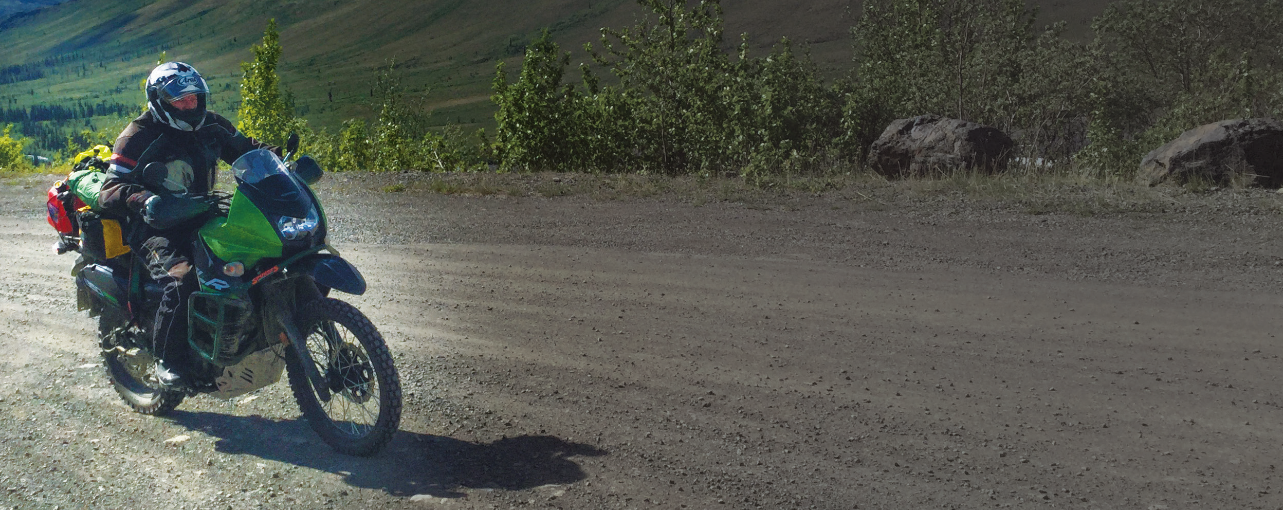
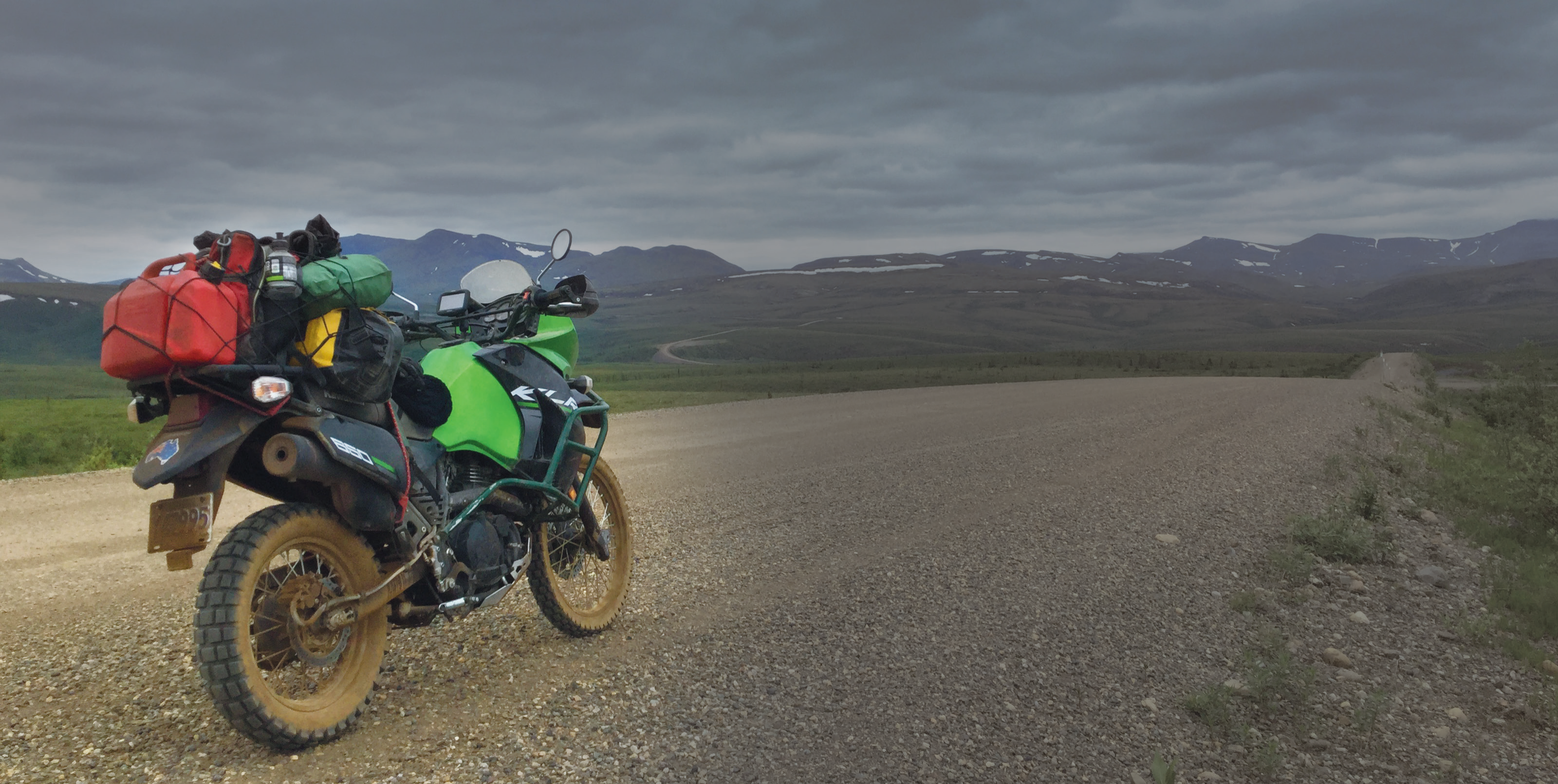
Joe, my riding mate from Tacoma, had his 800 Tiger and I the KLR at Mile Zero, near Dawson City, before heading north on a great compacted-gravel surface.
Our first stop was to be the Tombstone Territorial Park Interpretive Centre 70km away.
Cruising the wide, smooth, gravel road at 80kph was good practice for the 1700km we had to cover before our return to Dawson. As we’d both only just purchased our bikes and ridden up on bitumen roads, the forgiving nature of the surface gave us an easy introduction to the bikes’ gravel manners.
The jagged skyline of the Tombstone Range at the head of the North Klondike River greeted us at the lookout a little further up the road. This area was popular with hikers and saw quite a deal of traffic.
That traffic lessened the further north we travelled.
The next section of road saw us climbing into the area of the Blackstone Uplands, known for Dall sheep and the tragic story of the patrol, which, in the winter of 1910-1911, lost its way travelling south from Fort McPherson. All members of the group perished.
Buying a Bike in Canada
Buying a bike in Canada’s British Columbia (BC) is a simple process. Direct flights from Sydney and Melbourne make the Vancouver area the logical starting point. Craig’s List is then your go-to website. KLRs, GSs and KTMs are plentiful, with the odd V-Strom here and there. DRs are much harder to find.
I found my 2016, low-kilometre KLR advertised on Craig’s List at Spunkys Dealership on Vancouver Island. A deal was done and funds transferred. They then stored my bike for three months until I could get there.
On arrival the usual transfer of title paperwork was completed. A BC address is required, but the dealer or your motel address will do. A representative from BCIC, the government’s insurance arm, was called and arrived promptly.
Half-an-hour later I had the minimum three-month registration and comprehensive insurance cover for both Canada and the US. This cost $780. It could’ve been reduced significantly if I hadn’t planned to ride in the US and if I’d taken a copy of my Australian insurance no-claim bonus.
On completing the trip I purchased, again through BCIC, 12 months storage insurance costing $106. My bike is now laid up at a friend’s place waiting for my return.
Eyes Peeled
After 170km we arrived at Red Creek, named for the mineral-laden waters stained a rusty shade of orange.
We crossed Engineer Creek Bridge and entered the area of the Ogilvie River, where the canoeing opportunities all the way to Fort McPherson were only too obvious. The long climb of Seven Mile Hill out of the valley to the Ogilvie-Peel look-out provided a sobering panorama of the enormity of The Yukon wilderness. Apart from the road, there’s no evidence of any intrusion by man for as far as the eye can see, and the backdrop of the Ogilvie and Peel Rivers running through the valleys framed by the Ogilvie and Richardson Mountains was a truly stunning expanse to ponder.
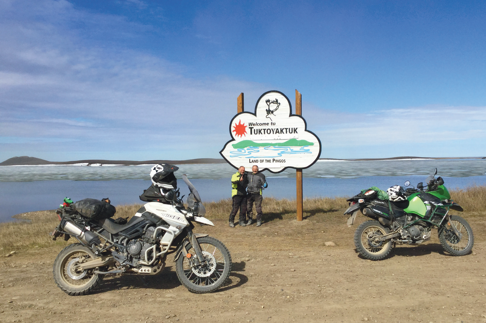 Author Don and offsider Joe celebrate arrival in Tuktoyaktuk, a small village on a peninsula jutting into the Arctic Ocean.
Be prepared
Our stop for the first night was at Eagle Plains, a speck in The Yukon wilds, with the odos showing 370km.
Eagle Plains was an interesting stop.
It has a motel with a bar and café, a gas station and repair workshop, and I’m told an emergency medical facility.
It’s not cheap, with rooms that can sleep four costing $170. However, when you see the permafrost tent-site option it’s easy to find the cash. It’s best to book early as rooms fill fast if the weather closes in.While none of that was especially different or interesting, we wondered why anyone would build a motel and service station on the top of an exposed ridge in The Yukon wilds. The weather howling through there in winter must be horrific.
It’s bad enough in summer, with rain, sleet, snow and temperatures well below freezing a common occurrence. At least you can be prepared. You can see the weather approaching for kilometres.
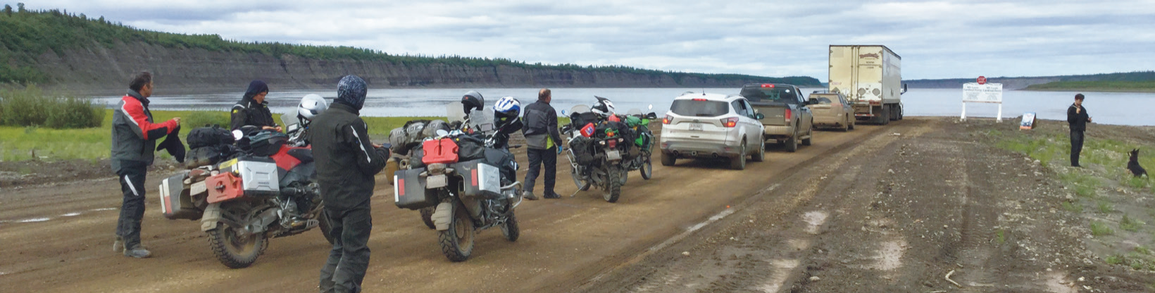 Queued for the ferry.
Berm shot
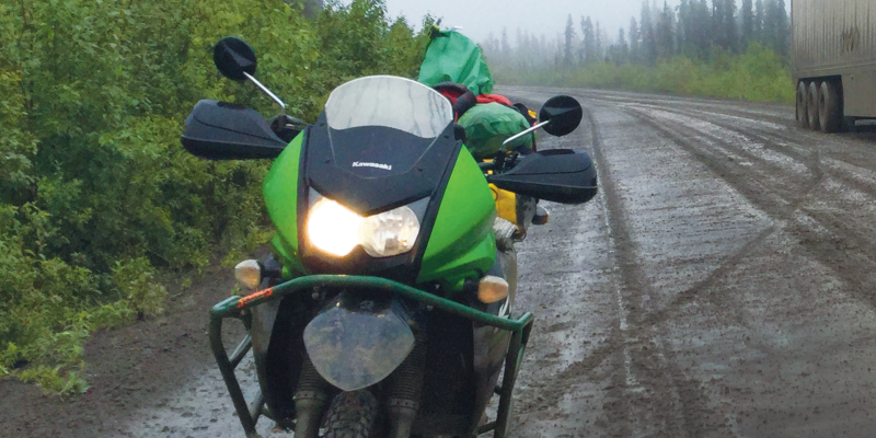
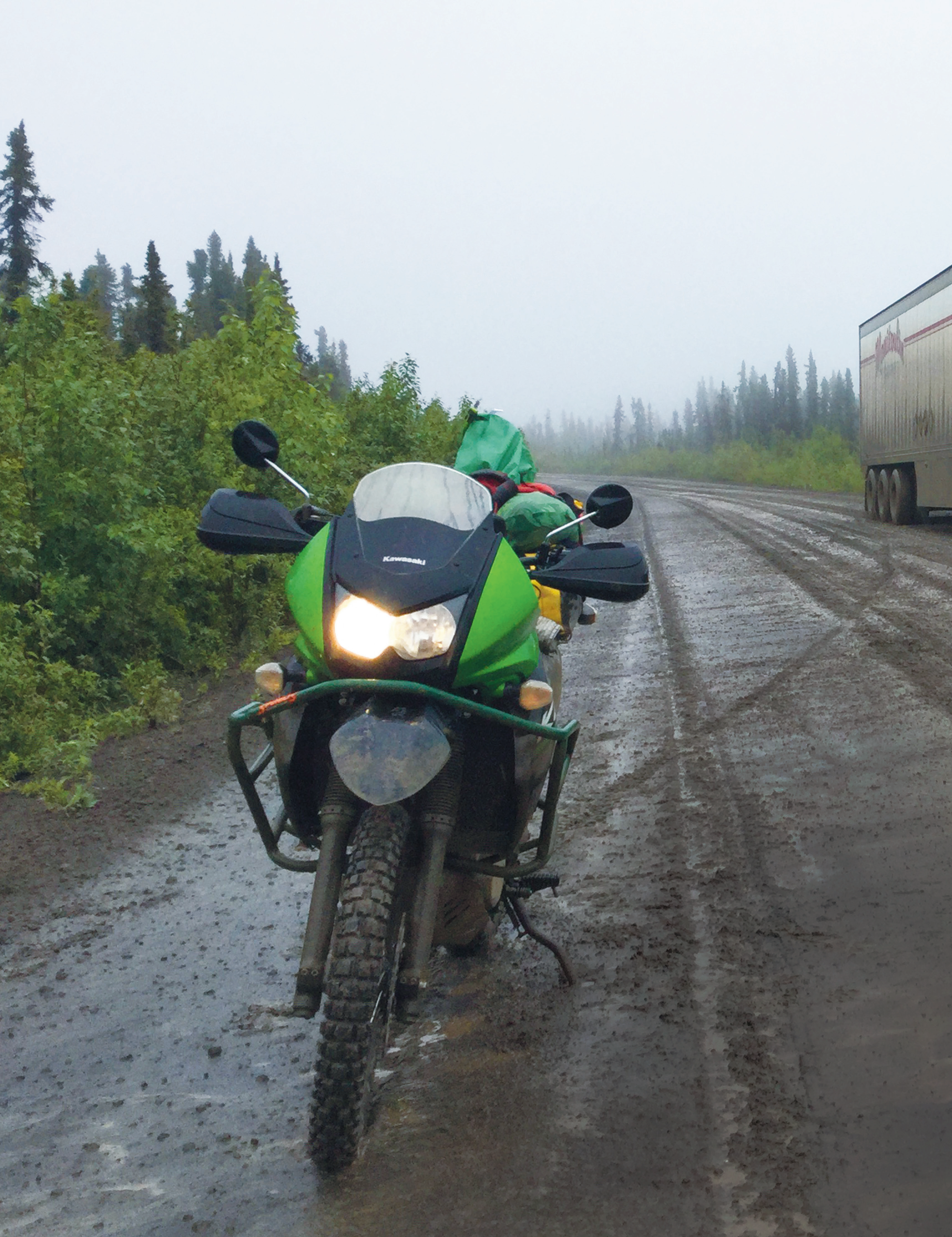
The next morning saw us helping right a GS and trailer which had gone wheels up in the first mud patch of the trip, and then, after a further 35km, we arrived at the Arctic Circle.
This was a popular turnaround point on the Dempster, but the improved road to Tuk now saw far more travellers continue heading north. It was also where we saw the courtesy of the truckers on the northern roads as one waited patiently for us to finish our photos before following us north, thus not forcing us to pass on the gravel.
Cloud and misty rain slowly encircled us as we climbed towards the North West Territories border. The muddy descent from this pass was tricky, with three Canadians on BMWs leading the way.
The nature of the ride in and out meant a tendency to meet up with the same riders along the way. Thus, after descending on to the Mackenzie lowlands and riding to the Peel River ferry crossing, the five of us were together again.
We bypassed the small First Nations settlement of Fort McPherson and rode on to the Mackenzie River crossing where the ferry traced a leisurely triangular circuit servicing the Dempster and the Gwich’in village of Tsiigehtchic.
From there a two-hour ride across loose, new gravel saw us arrive at the next overnight stay in Inuvik. This road across the lowlands was built on a flexible berm of gravel, in places many metres high, thus avoiding the frost heaves that plague conventional roads in the Arctic.
Inuvik, with its population of 3500,is the centre for the Western Arctic. It has a couple of motels, a campground, a couple of bars and a great yellow school-bus café tucked away on a back street.
Camping in the Canadian wilds
Canada has an extensive Provincial Parks system.
Typically a campsite will have an RV pull-through or back-in area, a wooden picnic bench, a fire pit and toilet facilities. Fresh water may also be available. A BC site costs $21, Yukon $12, while Ontario is the dearest as it requires a one-day vehicle pass as well and may cost up to $45.
Popular areas may need bookings, but usually first in gets the spot. Your money and details go on an envelope and into the collection box and the receipt on the post at your site. A KLR and a one-man tent on an RV pull-through site looks quite amusing.
When looking for a wild campsite it’s best to pull up at a nice lake or stream, take off your helmet and check for black flies, mosquitoes or midges. Next, walk around the area and look for bear signs such as prints, scat or fur on bushes or trees they’ve rubbed against. Then ignore all this and pitch your tent because at least one of these buggers is going to eat you anyway.
Seriously take the time to read up on bear safety. You’re sure to see bears, and the grizzlies of the north are massive.
Canadian Tyre, your go-to place for bike consumables and camping gear, has bear spray for $50 on proof of identity.
They also do a great line of bombproof dry sacks.
 The road is still a work in progress with only a light-load rating.
Blind luck
Day three saw us ride the new road to Tuk and return.
This section of road had caused all sorts of problems for riders already, with horror stories of broken bones and bikes, and even bikes being abandoned leaving riders to fly out. Such horrors are very much weather-dependent as the road is still a work in progress with only a light-load rating.
On the way in a 20km stretch was newly gravelled. While harder to ride, we got through with few issues. What we didn’t know was that the gravel had been turned during the day and not rolled. We hit the soft, rutted mess at 70kph and I did what all riders do: crossed my fingers, closed my eyes and hung on as the KLR was launched all over the road.
That I managed to stay on was due to luck, certainly not talent.
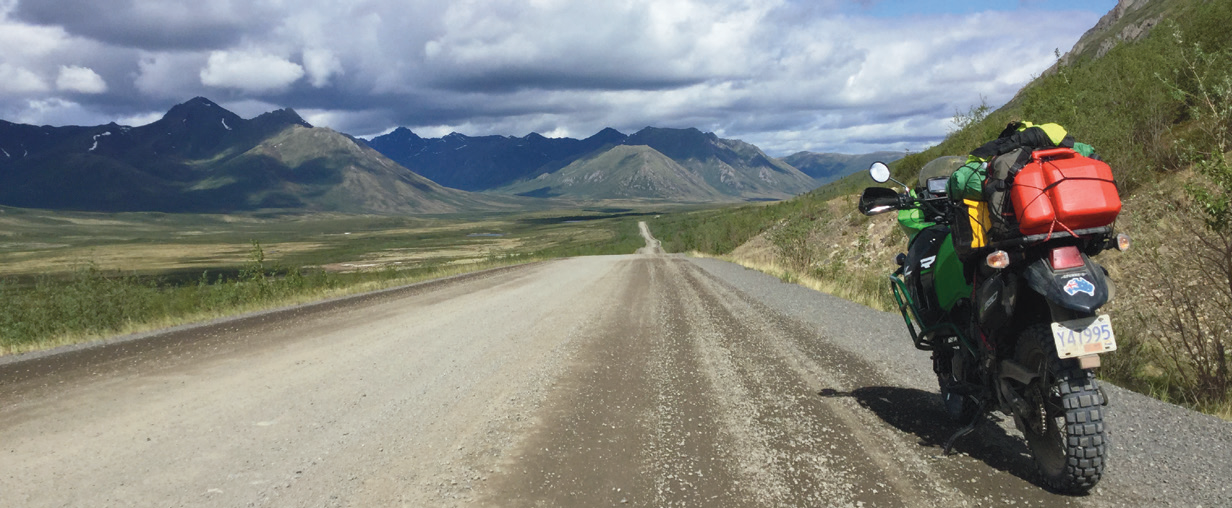 Apart from the road, there’s no evidence of any intrusion by man for as far as the eye can see
Diversions
I lived in Canada for 12 months back in the mid-1980s and revisited in 2015 so didn’t have the need to do the iconic routes such as the Icefields Parkway or the Alaska Highway. Most first-time visitors would want to see those. Indeed, much of the latter is a mere shadow of the adventure route it once was, now more akin to riding the Hume Highway on a ’Wing with a trailer.
Always keep in mind Canada is a big place with massive distances to cover.
As an alternative route to Whitehorse try the Stewart Cassiar Highway which runs 870km north from Kitimat to its junction with the Alaska Highway near Upper Liard. It was on this remote road, which parallels the coastal mountains, I came upon three black-bear cubs playing on the road. No, I don’t have a photo, as I wasn’t stopping to find out where the mother bear was. If riding this route, be sure to drop into Hyder Alaska and then ride the 30km of gravel to the Salmon Glacier overlook. The spectacle of a huge glacier pouring from the mountains and performing an elegant right-angled turn is never to be forgotten.
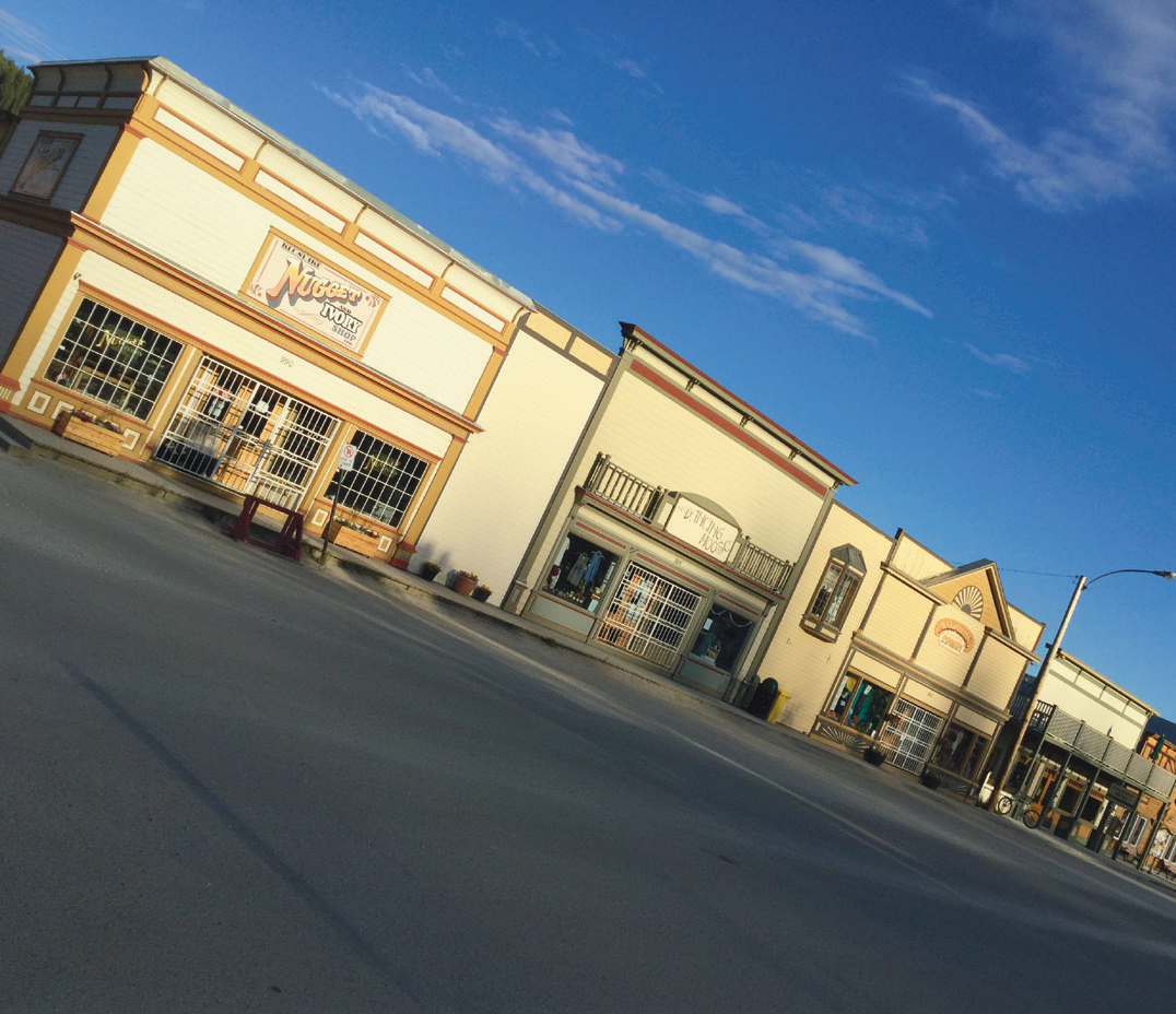
The Yukon’s Dawson City is worth a few days to visit.
It’s full of character and eccentricity best displayed by the line of people keen to do the sour-toe cocktail.
Of course, it’s also the starting point for the Top Of The World Highway and all points to Alaska.
Heading south from Dawson, I’d recommend a run down the Robert Campbell Highway. This remote road has a 360km stretch of gravel running through the wilderness. Joe and I saw one other vehicle when we rode the 290km section below Ross River. Ross River is also the starting point for both the North and South Canol roads. The North peters out in rugged wilderness near the NWT border, while the South traverses wild terrain to eventually meet the Alaska Highway. I drove the South Canol in an SUV in 2015 and can highly recommend it.
 It’s best to book early as rooms fill fast if the weather closes in.
Food. Fast
The ride to Tuk passed lakes still with their coating of ice and pingos – mounds of earth-covered ice – pushing skywards from the tundra. At one photo stop a car of Tuk First Nations researchers stopped to ask if we were okay. A pleasant conversation followed where the consequences of climate change on traditional lifestyles was discussed. One elder opined that although the season of sea ice was shortening and new animal and fish species appearing, the most worrying aspect was the time it was now taking for the sea ice to freeze to a sufficient depth to be safely traversed.
To say the Inuvialuit hamlet of Tuktoyaktuk is pretty would be a stretch, but let’s say it had a certain rustic, ram-shackle, weatherbeaten charm as it sat on a peninsula jutting into the Arctic Ocean. I suspect local residents had been surprised by the number of visitors with the opening of the all-weather road.
Prominent among them were the adventure-bike riders, who were there in their droves, relishing the challenge of the ride in and the opportunity to put that front wheel into the ocean. Luckily the sea ice, although easily visible, had moved offshore the previous week.
Tuk has little in the way of tourist facilities but has a general store for food, fuel and the all-important ‘I Made It To Tuk’ stickers. Entrepreneurial locals had already set up a barbarque fast-food tent on the gravel foreshore carpark which also doubled as a campsite. Burgers, hot dogs and cold drinks made up our lunch menu.
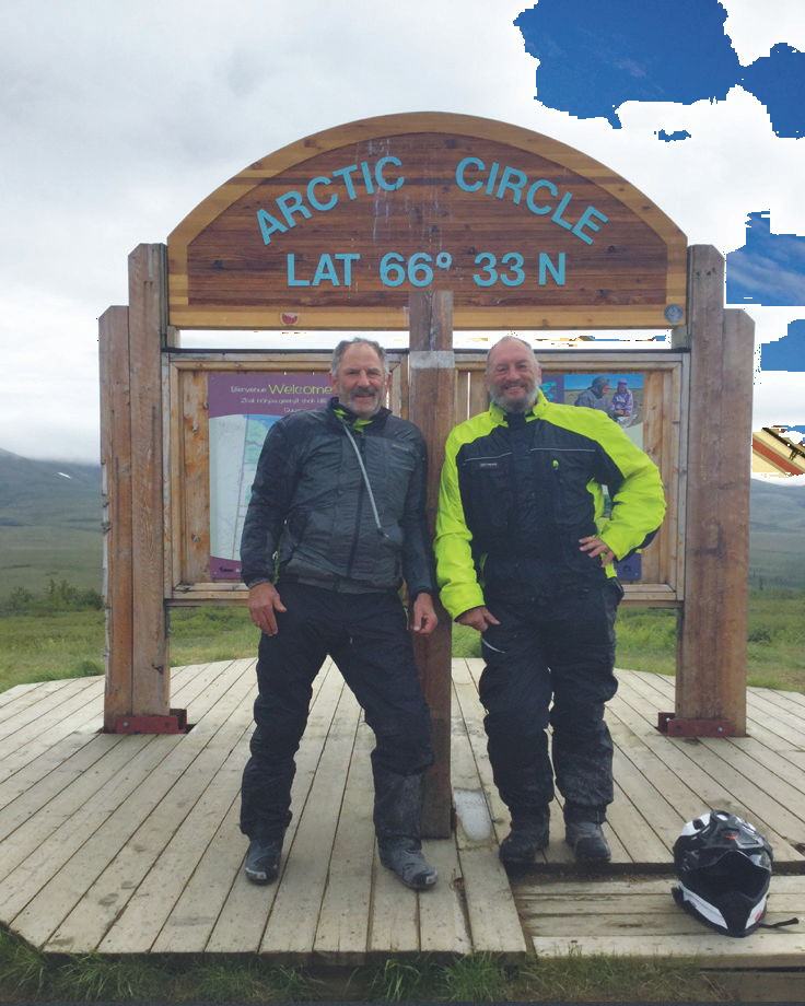 The Arctic Circle was a popular turnaround point on the Dempster Highway.
Big
Day four saw an uneventful ride back to Eagle Plains where we learned how truly fickle conditions can be, and why adventure travel in the Arctic is never to be taken lightly.
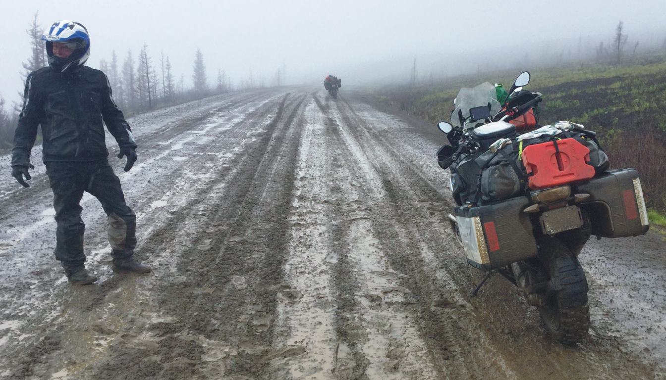
Overnight rain turned the road out of Eagle Plains into a nightmare. Calcium chloride is used as a dust-reduction and compaction measure on northern roads.
Unfortunately it retains moisture for prolonged periods. Thus, when wet, this muddy gloop offers traction roughly similar to ice. With that in mind we made an early day-five start on the ride south.
We were fortunate in being early as the road hadn’t been churned up by too many vehicles, but even so the bikes were all over the road with the front and rear ends rarely doing anything remotely similar.
After tiring of this I decided to run on the verge where no one had been, only to do constant Jason Crump impersonations as the rear came around.
Who ever heard of a KLR overpowering the conditions? At least the front end ran relatively straight.
Conditions continued like this until we dropped to the Ogilvie where the harder-packed gravel provided some relief.
However, it was on this section Joe had a sphincter-tightening close encounter of the moose kind. A full-grown female charged out of the scrub on his left about 10m in front of his wheel and into the scrub on his right. His comment after he stopped and his heart settled was, “It was as big as my garage door.”
He wasn’t exaggerating.
Recommended
An easing in the weather led to improved road conditions as we approached the Tombstone area.
While we’d struggled on the way south we passed other riders heading north. The next day, while cleaning and servicing the bikes in Dawson, stories began to emerge of riders stuck at Eagle Plains, unable to head either further north or south.
The Dempster is a great adventure ride.
However, as it’s five days of remote gravel road, much of it above the Arctic Circle, it’s not a casual affair.
Would I recommend it?
Too right.
Logistics
Fuel for the Dempster is available in Dawson, Eagle Plains, Fort McPherson, Inuvik and Tuk. Joe and I each carried extra fuel in case, after 300km, we were turned around by the weather and had to make our way out. Food is available at Dawson, Eagle Plains, Inuvik and Tuk. Don’t rely on Fort McPherson as supply is very limited.
I highly recommend full-on dirt tyres. I purchased TKC80s from fortnine.ca and had them shipped to Yukon Yamaha at Whitehorse at a very reasonable cost. I then contacted Yukon Yamaha about holding the tyres and booked work-shop time, as summer is their busy season, to have the tyres and heavy tubes fitted and an oil change. I can recommend both these businesses.
As a safety precaution Joe and I each carried a tent and sleeping bag, extra food and water along with the usual range of tools and first aid gear. I didn’t carry a SPOT tracker as I felt the roads would be fairly well travelled. In hindsight, and after travelling on remote forest service roads later in my trip, I’d revise this and will carry one on my next Canadian-US foray.
Finally Joe and I highly recommend The Bunkhouse in Dawson City as the biker place to stay. It’s reasonably priced, kept meticulously clean and has a free pressure washer which you’ll definitely use. Each of our bikes needed an hour of washing to clear the concrete masquerading as mud after our return from Eagle Plains.


Comments