

- It’s what we do – adventure motorbike riding tours magazine news events
- Dakar 2019: The Wish
- Yamaha Ténéré 700: First Aussie Ride!
- Under African Skies – australian adventure motorbike magazine
- Ducati Multistrada Enduro 1260
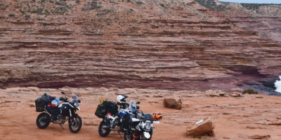
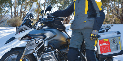
- Congregations (NSW and WA)
- Royal Enfield Himalayan – adventure motorbike magazine – australia
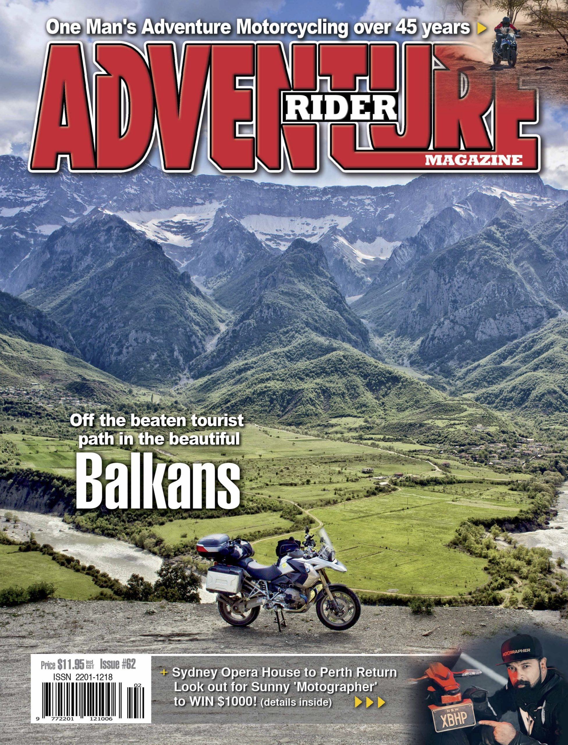
- Kimberley Dreaming
- Ural Adventure Ride = australian adventure motorbike magazine
- Bali Tour 2019 – Perth Adventure Riders
- Scott Britnell
- Window Shopping
- Fathers Day = australian adventure motorbike magazine
- Blue Banger Run = adventure motorbike riding
- KLRRR
- Best Job In The World
- Tubeless Bliss with Miles Davis
- Retyrement with Andy Strapz
- Food For Thought with Karen Ramsay
- Checkout
- Fit Out
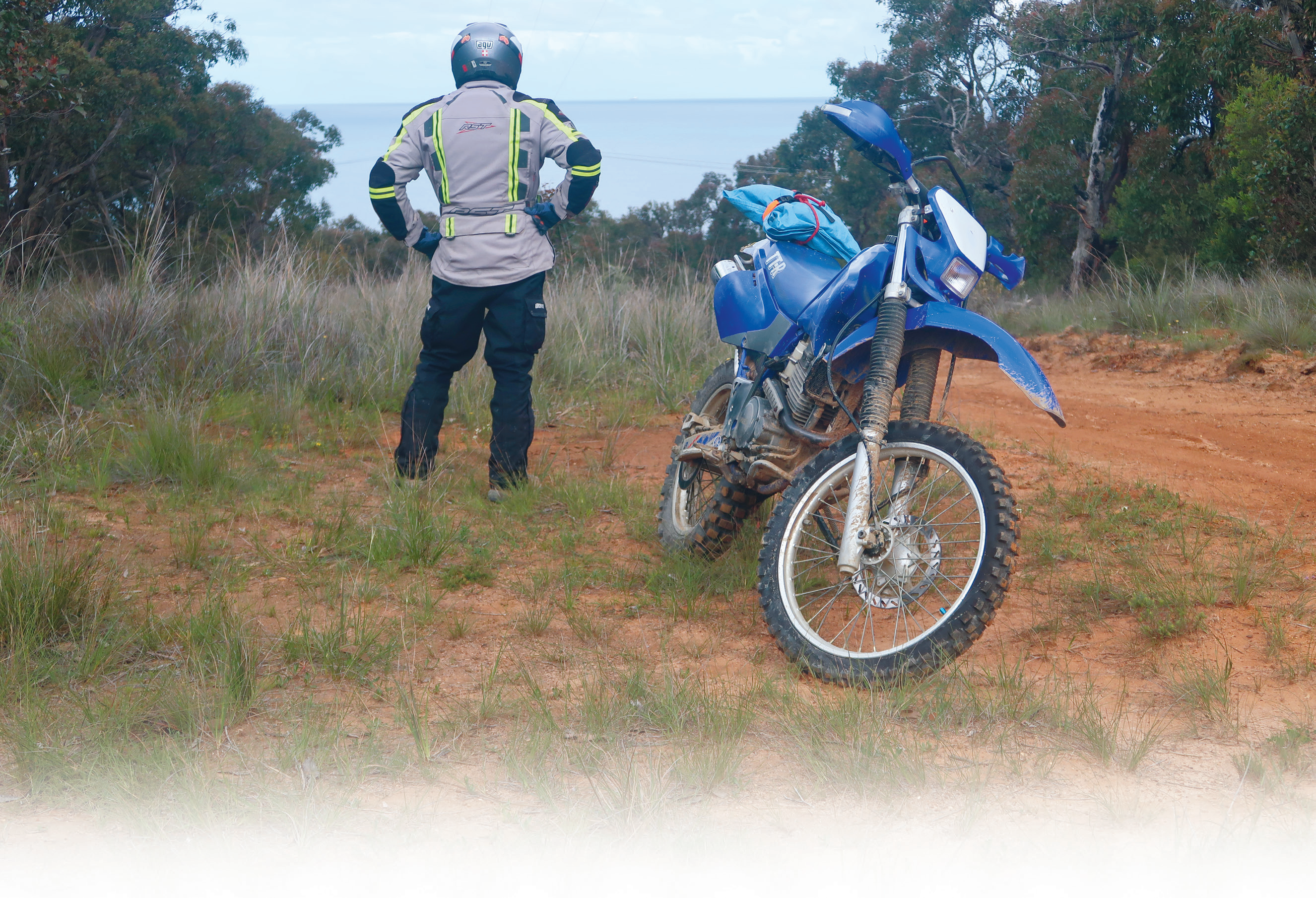
The Great Otway National Park and Otway Ranges – ‘The Otways’ – are a Victorian forestry wonderland offering any amount of riding adventures mixed with remnants of bygone sawmilling days. Graeme Sedgwick took his TTR250 for a look-see in Blue Banger Run.
I shifted down to a more prudent gear as the track began to grease up thanks to some gentle rain. I wondered if I’d made the right decision in taking my TTR250, ‘The Old Blue Banger’, into The Otways for some therapy.
Fortunately, the further I progressed the more enchantedI became with the glistening landscape of ferns and tall timber.
My ambition was to take as many interconnecting south-westerly tracks as I could find to immerse myself in some of The Otways’ best.
Blue Banger Run
Strait up
Located approximately 160km southwest of Melbourne, The Otways sprawl across more than 100,000 hectares bordering Bass Strait to the south and, arguably, some of Victoria’s best grazing country to the north. The Great Ocean Road weaves back and forth alongside the Great Otway National Park and range, and, attracting more than 2.7 million visitors means The Otways are a popular tourist destination for those looking to get close to nature.
Complemented by peaceful watering holes like The Brewery at Forrest and The Beechy Hotel along the way, there are some stunning gaps between trees to catch views out over the blue stuff that separates the Aussie mainland from Tasmania.
On board my old, radiatorless, electric-start TTR250 – or on any adventure bike – Otway riding is jam-packed with all sorts of short and long adventure options.
 The Otways are a popular tourist destination for those looking to get close to nature.
Stick it out
On the map it all appeared fuss-free.
Once on the trail some of the more obscure passages I’d chosen presented more technical twists and climbs than I’d bargained for, and by my measure, some kamikaze downhills.
But the commitment had been made. I told myself,‘Nothing worthwhile comes easily!’ and ‘The familiar can dilute an adventure’s flavour!’ I was determined.
Keenly aware there are no prizes for overestimating one’s abilities, especially on a solo ride in country that can demand every ounce of a rider’s energy and ability, the objective was simple: stick to the plan I’d outlined to others. I had a PLB, mobile phone, small tent and munchie pack aboard.
 Lardners Track is a blast, with views between bends and any number of short straights.
History
Thankfully, The Otways is a well mapped area, so there are plenty of accurate reference points and get-out-of-trouble options.
Rain is one of the biggest influences in the region, with localities such as Tanybryn and Weeaproinah recording some of the State’s highest falls – over 1900mm annually. That means The Otways’ environment can, in a blink, turn tracks into bobsled runs.
Mindful of this, and in view of the patchy clouds above, I took a cross-country route via more navigable forestry tracks to a point above Webster Hill Plantation, southeast of Gellibrand and north of Olangolah, smack in the middle of The Otways. Along the way there were opportunities to discover any number of overgrown sawmill sites scattered throughout the area. Sites such as Henry’s Mill and a settle-ment which existed along the West Barwon River, together with what remains of a tramway formation and tunnel. Knott’s Mill was another vague memory of bygone years, and so were the remains of concrete-machinery foundations close to Wait-A-While Road and Phillips Track at Wyelangta.
Sawmilling during those halcyon days supplied a variety of timbers to places like Colac, Geelong, Hamilton, and the Ballarat and the Creswick gold fields.
 The Otways’ environment can, in a blink, turn tracks into bobsled runs.
 More navigable forestry tracks around Webster Hill Plantation.
Spoiled for choice
I eventually hit Asplin Creek Road and ran southward into Webster Hill Plantation’s less-trafficked, mud-spattering trails toward Lardners Track.
Hard-packed and with plenty of ball-bearing patches – in contrast to Webster’s loamy, puddled, clay-surfaced passages –Lardners Track is a blast by comparison. Its wider views between bends, with any number of short straights, made the run to Olangolah a hoot.
I was ever alert for oncoming traffic, even though it was remote country.
There’s always a chance of oncoming traffic, even though it’s less likely midweek.
With Webster Hill Plantation behind me the furthest destination of my plan loomed: Aire Valley Plantation.
Bursting with enthusiasm and under more blue sky than I’d seen all day, the timing couldn’t have been better.
South from Beech Forest down Old Coach Road was the ticket, over the bridge crossing the Aire River. I veered left onto Horse Paddock Road and followed a swinging, high, line around the valley’s contours, revealing many vistas and rewarding me for all the slogging it took to get there.
The Old Blue Banger, like its rider, was completely engaged.
Switchbacks and hairpins made Satin Box Road an almost never-ending twister that climbed to a junction which offered tracks named Midway, Seaview and Aire Road.
There was no need to choose. I rode them all.

History
The Aire Valley Plantations exist due to the efforts of post-war refugees.
These hardy people lived and worked in Forest Commission camps of Stanley huts adjacent to where redwood plantations were established as a trial in 1936.
The camps were particularly important in an era before a State Forest road network was established, and before reliable vehicle transport made daily commuting to nearby towns a viable proposition. The unemployment relief camps provided an important pool of labour, and by the mid 1930s the Forest Commission employed almost 9000 men. Depending on the nature and use of the forest camp, workers could be accommodated for periods of several days, weeks or months. In the refugee camps, it could even be years.
 The redwoods offer a peaceful place to stop.
The bulk of the Aire Valley’s planting work was done by post-war immigrants and refugees from Lithuania, Latvia, Estonia, Poland, Czechoslovakia and Yugoslavia. The first arrival of ‘Balts’ – as they became known – camped for up to two years before construction of an all-weather road network by the Forest Commission in the 1950s. That led to the closure of the Aire Valley Plantation Camp.
The redwoods are still there to be enjoyed and offer a peaceful and awe-inspiring picnic site or rest stop.


Comments