
- It’s What We Do
- Riding the Cordillera Blanca – South America at its best
- BMW F800GS – Off to the Safari Enduro
- Industry Player – Geeze Goldhawk
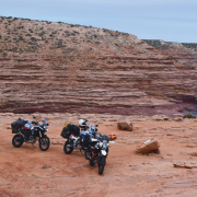
- White sand to red dust – A PLB story
- Crazy Kunzum La – A tough run in the Himalayas
- Ladies only – BMW Off Road Training
- Off-road Test – Husqvarna 701 Enduro
- Across Australia – From the Indian to the Pacific
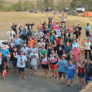
- Tour Of Duty: A Victorian three-day
- KTM Rallye 2016 – KTMs all over the place
- Domestic bliss – At home with the Ducati Multistrada Enduro
- Reader’s Ride – The Flinders
- Trials and tribulations with Karen Ramsay
- Dunns swamp – Another great secret location
- How To Ride with Miles Davis
- Checkout
- Fit Out
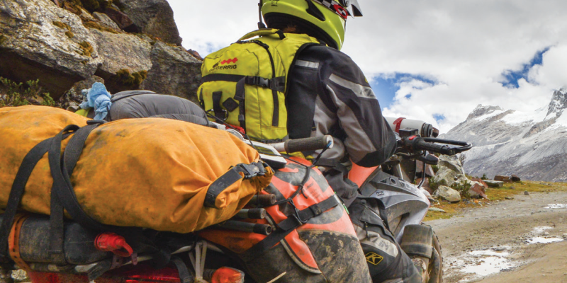
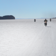
Riding The Cordillera Blanca
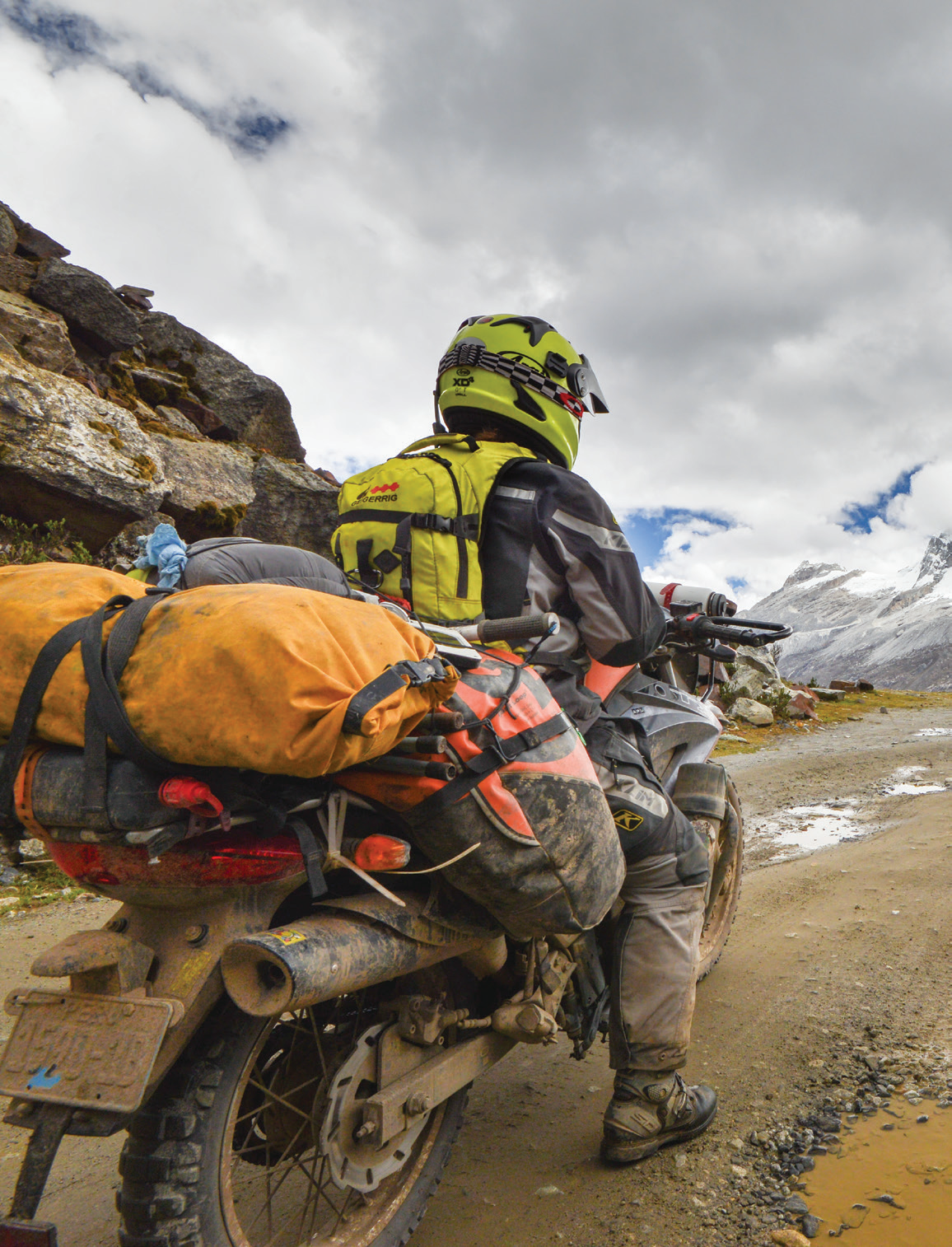
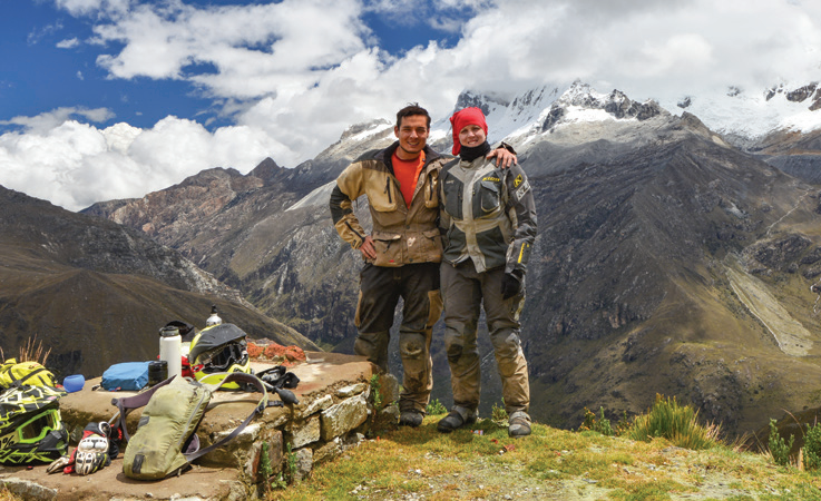
South America is an adventure-riding El Dorado. Naomi and Alberto share some of their considerable knowledge and excellent photography. If you’re thinking of seeing Peru, here’s some great info to get you started.
If you want bang for your buck head to Huaraz, Peru, the gateway to Huascarán National Park located in the central Peruvian Andes.
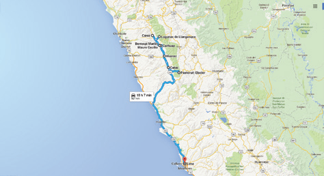
Huaraz is easily accessible from the Panamerican Highway via major routes such as highway 14A or the very popular Cañón del Pato route, famous for its unique rock tunnels. Huaraz is the capital of the Ancash region, and is a large city with many services and comforts. It’s a beautiful setting and on a clear day you’re rewarded with views of the white, snow-capped mountain peaks of the Cordillera Blanca.
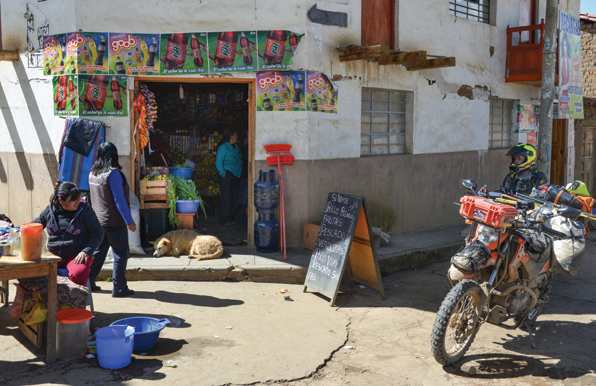
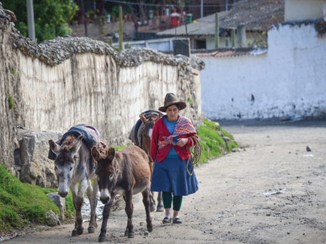
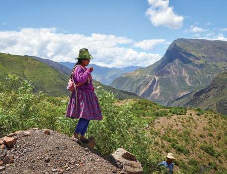
Peruvian culture
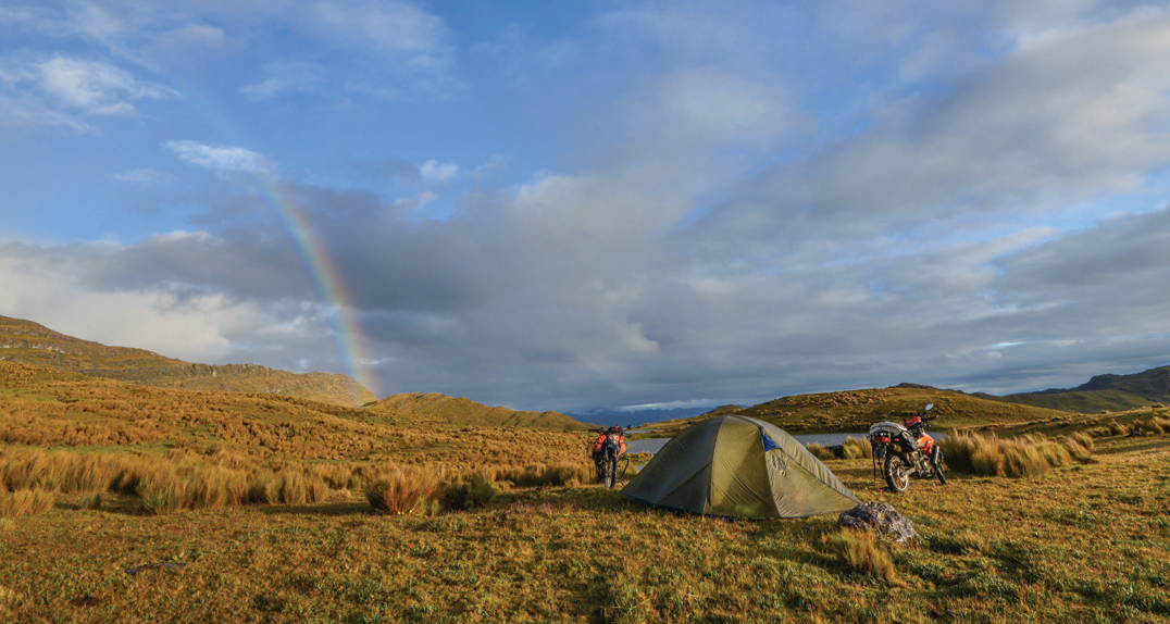
If you prefer to spend your nights in a nice hotel, making Huaraz your home base is a good place to start, however there are camping opportunities – both official and unofficial – in the surrounding area.
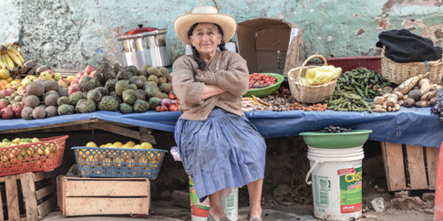
Culturally Huaraz has a lot to offer, and spending a few days exploring the city and sampling Peruvian culture will give your body a chance to acclimatise to the altitude (3050m above sea level). You can walk through a local market or sit down at one of the many restaurants serving up comida típica (Peruvian food). Take a break in the Plaza de Armas and watch the local ladies dressed in bright coloured clothing show off their llamas to the tourists who flock to the city.
Black and white
Huaraz is located in the valley of Callejón de Huaylas with the Cordillera Blanca (White Mountains) to the east and the Cordillera Negra (Black Mountains) to the west.
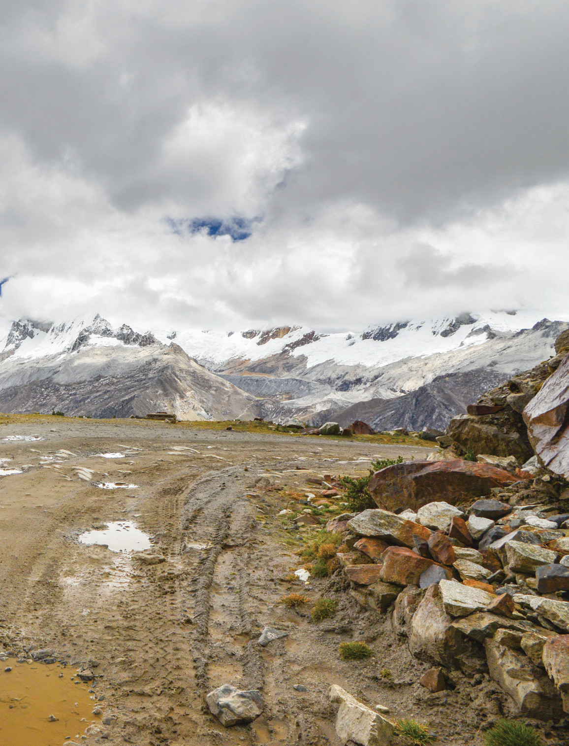
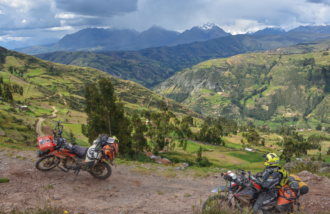
There’s a main route, highway 3N, which is double-lane traffic and paved, that runs right through the valley and can be used to access the many points of interest as you ride the region. Huascarán National Park is situated to the east of highway 3N and is home to Peru’s tallest mountain, Nevado Huascarán, which stands 6768m tall.
This massive mountain can be seen while riding on highway 3N, but the best place to admire the view is the Portachuelo Pass.
The summit of this pass measures 4767m and is accessed through the park entrance to reach Lagunas de Llanganuco.
Peak-a-boo
The Llanganuco park entrance is reached by dirt road starting from the town of Yungay.
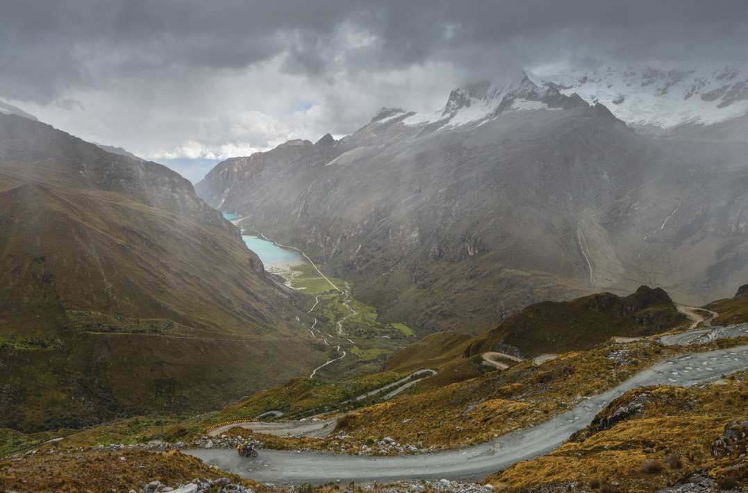
This road enters the park through a narrow valley with steep vertical rock walls on either side. Waterfalls can be seen cascading down these walls and the natural beauty surrounding you as you ride is surreal.
It isn’t long after entering the park you reach Laguna Llanganuco, which is actually a pair of lakes, Laguna Chinacocha and Laguna Orconcocha, connected by the glacial river that feeds them. The road through the park passes right beside the lakes, which are spectacular as the water surface shimmers a brilliant turquoise colour. Along the lake shores grow the Queñual trees with their red bark and intricate branches. The road climbs past the lakes and into the mountains, travelling 15km and gaining 900m of elevation to reach the Portachuelo Pass summit. Sitting at the viewpoint provides views of Nevado Huascáran and other peaks in the area such as Nevado Chopicalqui, Nevado Huandoy and Nevado Pisco.
Cat’s whiskers
Further south along the valley highway 3N, the turnoff for the road to visit Chavín de Huántar is found in the town of Catac.
This nice, smooth road is paved until the summit and boasts views of the Cordillera Blanca on either side and large open grass-lands before the climb into the mountains.
Laguna Querococha, a glacial lake with stunning surroundings, is on the route. Pointed mountain peaks, with just a hint of white snow, guard the lake from the northern side and the shoreline is dotted with pampas grass.
Following the road further into the mountains through a series of switchbacks will have you grasping for the throttle and whooping with joy. Mind the buses and trucks though, as they tend to make use of your lane around corners.
The road summit is punctuated by the Tunel de Kahuish which lies at 4516m above sea level.
Once through the tunnel the road turns to dirt and is a bit rough from all the bus and truck traffic, however it’s not far to the ruin of Chavín de Huántar which dates back over 3000 years and was a ceremonial centre for the Chavín culture. Walking the grounds of the ruin one can appreciate the stonework and intricate sculptures of the pre-Colombian culture. Among these sculptures are temple guardians known as Cabezas Clavas, mythical humanoid stone-heads with feline features, and they can be seen up on the surrounding walls of the main temple.
Road block
Starting from the town of Carhuaz there’s an excellent paved road with plenty of smooth turns that leads to another entrance to the Huascarán National Park.
The valley is more open than the entrance to Llanganuco, with grasslands supporting grazing cattle and beautiful purple flowers along the roadside. The road parallels a glacial river that runs through the valley before climbing an endless series of switch-backs to the summit of Punta Olímpica at 4890m.
The weather can change considerably through the climb, going from sunshine to snow at the pass. At the summit there’s a long tunnel, an impressive feat of engineering measuring 1384m in length, that takes you to the other side of the mountain.
The switchbacks are just as much fun on the way down, or a quick visit to the exit of the park yields alternate views of the region.
If you’re looking for doses of adrenaline, you can take a detour near the tunnel entrance at the top. The detour takes you up to the ‘old’ Punta Olímpica pass, and is an out-of-service narrow road in rough shape that snakes up to rewarding views of the surrounding mountains. Be aware this old pass can be covered in deep snow and large rocks may be blocking the road, making it a real challenge on bigger bikes.
Mucho ass
In the Cordillera Negra lies Laguna Wilcacocha, a little-known small lake in a simple setting of grass-lands and local houses. Camping is allowed around the lake and with incredible views of the Callejón de Huaylas valley and Cordillera Blanca it’s a fantastic place to be.
The road to the lake is a narrow, rough dirt track that’s challenging in sections. Access to the road is across the Santa River from the main highway at the town of Santa Cruz. The lake is home to wild ducks, while local donkeys are scattered around the perimeter.
POIs
Take a visit before time runs out on Pastoruri Glacier, a rare site to see this far north in South America.
The walk from the parking lot to visit the glacier gets longer every year. The glacier is receding quickly and at over 5000m above sea level will have you gasping for air with every step you take. The road to reach the glacier starts from just a few kilometres south of Catac and is a single-lane dirt track. It’s in pretty good condition though, and it’s typical to see tour buses bumping along, kicking up dust, as they shuttle tourists back and forth.
With a few points of interest to check out along the way,including the thermal waters, native art paintings and Puya Raimondi plants, combined with the mountain views, the ride is a pleasant one.
Flower power
If returning to the coast via Punta Winchus you’re in for a treat.
The road is a paved, but narrow, single-lane track filled with endless switchbacks and turns. It’s a treat for the senses and a road of pure joy for the motorcycle enthusiast.
From Caraz the road leads up into the Cordillera Negra. Views of the white mountain tops can be seen in the distance but the narrow road will demand most of your attention. Watch out for grazing livestock and pedestrians, as well as large trucks in blind corners.
At the top of the pass you’ll find one of the very few Puya Raimondi forests left.
The Puya Raimondi is the largest pineapple plant in the world.
The flower, which can reach 12 metres in height, grows from a large spikey base. Each plant can have close to 8000 flowers and live over 100 years. The flower only blooms once every 50 to 75 years, so consider yourself lucky if you catch one in bloom.
From the summit you can see the tall mountains behind you as the landscape gently slopes down towards the Pacific Ocean and your return to the Panamerican highway that leads back to Lima.
Good time
There are countless dirt roads that head in every direction into the mountains in this beautiful part of Peru. Take your time to explore.
If you do, you’ll be rewarded with many spectacular views of the mountains, valleys, rivers, lakes and high-road passes.


Comments